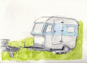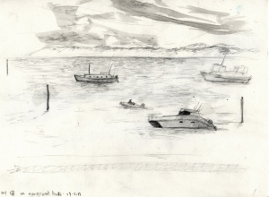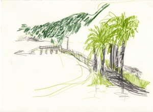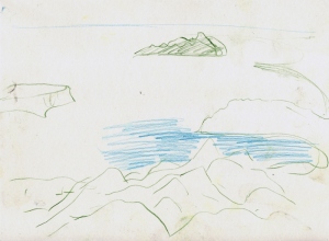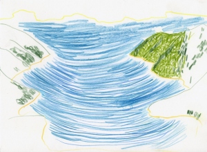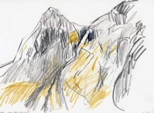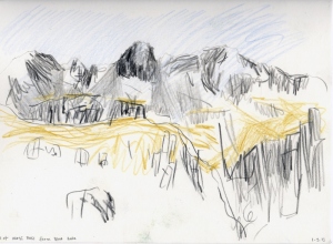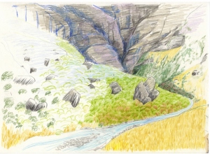
The last day
I had been reluctant to do this, but here it is the final blog entry….
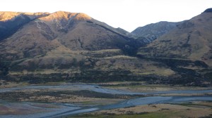
April 21st – After a bacon/bananna pancake breakfast in Riverton, I took off to walk the 26km down Oreti beach to the Otira river. Dismal weather in the morning had cleared up by the afternoon and I had dramatic views back towards the Takitimus and Longwoods. Oreti beach reminded me so much of the beginning in Northland on 90mile. A rather emotional day this second to last, moments of so much joy, dancing and singing loudly (there was no one around on this freezing beach at the bottom of the world). Also many sad moments that my adventure was soon to end.
April 22nd – I decided that I couldnt be bothered carrying my pack on the last day…my backpack, tent, stove etc didnt care that it got to the sign post or not. And, I knew the weather was going to be bad, I had to walk down highway one, I wanted the day to be over and done with as fast as possible, I decided to run the last 38.5km from the Otria river to the sign post at. I got up at 5am and took the minimal with me…perhaps the head torch would have helped as it was very dark. State highway one complely sucked! Hard on the legs and feet, traffic mainly comprising of trucks and Te Wai point commuters. I was really happy at about 10.30 Dean and Rachel drove past, I was getting pretty hungry and Dean had half a block of chocolate and 2 banannas – brilliant. “See you at the end. Are you going to run or walk?”, “Run” I said without hesitation, “Your Mad…We will be waiting for you at the sign post”
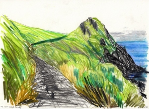
the last 7.5km of trail go around the back side of the Bluff Peninsula, and you dont see the sign post until you are about 300m from it, so the feeling that you have when you come around the last bend in the trail and there it is the finish is really quite strange. At this point I decided to walk, simply to take a little more time to comprehend the end more than anything. It was raining. Dean and Rachel were there waiting for me, and I was so greatful for this, it would have been terribly lonely otherwise. There really is not much there. After the mandatory photo huging the sign post we went back to Invercargil, for allday breakfast. Not a bad way to spend the last day of being 27. And that was that.
The Best of Southland
Currently I am sitting in the Riverton Pub, its 12.15am, not a dam chance of sleeping yet as a very loud and terrible band is playing (they are playing a version of the Troggs ‘Wild thing’, but have changed the lyrics to sing “wild sheep, I think I want to shag you….wild ram, I think Ill drench you…. Wild ram, I think ill dock you”. This really is the best of southland. so I figured I might as well write the second to last blog post, the internet computer is right next to the speaker.
After leaving Te Anau 7 days ago I have been in mission mode. Some of the biggest days yet and I am deffinitly feeling it. While the body doesnt hurt too bad, its just tired and Im beginning to question wether my shoes will hold together for the last 70km,
I hitched the 25km from Te Anau back to the trail after my rest and resupply, and walked a very short day of 6km to the first hut, Lower Pinchester hut. No one was there. A slightly grotty hut but I was happy to be back on the trail. As the next hut was 8hours (doc time) away, I didnt have enough daylight to get there, and seeing that the distance was 17km I figured that the track wasnt exactly a great walk. So went on a firewood mission (not that easy to find anything dry and the axe head was theatening to fly off with half a swing), manage to scramble together something to burn, for comfort mostly as it wasnt too cold. Did some much overdue drawing and read my track notes. While I was down at the stream, another TA walker turned up, I got a bit of a fright to see Dean sitting in the hut when I returned “Shit annother person, I was mentally preparing myself to be alone for the next week”.
Turns out, Dean and I had been crossing paths all the way down the South Island, and at one point were litterally an hour a appart. He had been in ‘Mission Mode’ for a while and was putting in some big days. We decided that we would walk to the next hut tommorow together and then revise the plan after that, maybe split off again and walk seperatly as I didnt think that I would be able to keep up with mission mode, but we ended up walking all the way to Colac Bay together.
The day from Lower Pinchester Hut to Aparima hut was thick Southland jungle and tussock bashing. We got rained on a little during the afternoon and were pretty soaked by the time we reached the hut at about 4.30. There are 2 huts at Aparima, the old and the new. We opened the door to the new hut, but there was someone already there. they wernt there but their stuff was spred around the hut, we figured that they must be out hunting. Decided to stay in the old hut as it was in decient condition refitted bunks. In an attempt to dry out, I got the fire going, constantly having to poke it and feed it as the wood was wet. A dripping figure appeared at the door – HAROLD! 🙂
After a pretty good sleep, the next morning with Harold leading the charge, we charged to Lower Waikari Hut. This section was timed in the track notes as 7 – 8 hours we did it in 4h15m. Lower Waikari Hut has become a Te Araroa hut, only 2 other people other than TA walkers had used it in the last year, both hunters. Because it wasnt raining and there was still 5 hours of daylight left, I decided to push on and do the next section (8hour doc time) a 500m climb then desent to Telford Burn Camp site. We made it to the camp in 4 hours. Low cloud but no rain.
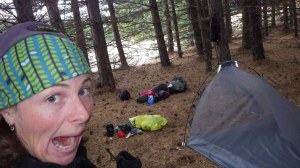
The next day was truely truely the most epic day I have had on the TA. We got up before dawn and got walking as the light crept into the valley. This section we were doing was across to Mt Linton Station, 19km private farm land that is only allowed to be crossed in light hours only. We crushed it out pretty fast, and at the Ohai road junction where I was origionally feeling like finishing, I felt fine, so we continued on, to the Woodlaw forest. At 4pm we exited the Woodlaw forest and still felt reasonable, so headed into Island bush a private patch of pine trees 5km long, again this was only to be crossed in daylight hours (which were very quickly dwindling) and permission needed to granted from the owners (Dean had already organized this) so in we went. I got my second wind and exited the bush at a run, by now it was precipitating persistantly. By now we were feeling pretty tired, it was dark, we were walking on a road with our head torches on, we were wet, and looking for a place to camp. In the end we climbed into a patch of Euculyptus trees in a farm paddock on the roadside. Crawled into the snail, rehydrated my backcountry meal and fell asleep. turned out to be a 48km -EPIC!
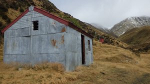
The rain had stopped by the morning, we packed up and were walking by 8, a longish day of 27km into the Longwood forest heading for Martins Hut the last hut (and grottiest) on TA. The track up to the first peak was very gradual, quite easy going and the bush was just beautiful. Lush, Mossy, ferny the forest was alive. Made it to the top of bald hill in good time, We were feeling happy, the sun was out and we could had a 360 degree view- behind us to the Takis, south to west to the hump ridge, south to Stuart Island, and east to Bluff. This is trail majic.
Made our way down to Martins hut (which seemed to be rotting on the spot as the light started to die, and Deans old friend Jordie from school who he hadnt seen in years and years, who lived half an hour from the hut, had come up to meet us with some beers, fresh bread, cheese, chutney, and chocholate chip cookies – ANGEL. Thankyou Jordy
Yesterday we walked 31km down the longwood water race, I hit the wall yesterday. a few boohoo moments due to exhaustion, very happy when we finally made it to the Colac bay pub for hot chocholate and wedges.
Today was a short day only 13km down the beach to riverton. Its time to finish this thing. Tommorow to Invercargill, then Bluff. Happy trails, Arohanui Hannah Husky
The Rain came in during the night
Wanaka to Queenstown Via the Mototapu
The Mototapu was brilliant, ruggard, steep as hell but totally gorgeous. I headed out from Wanaka along the lake frount in the semi dark with flat white and muffin in hand. 
 Overcast but still, I knew that there was some rain was heading my way at some point.
  About 5km into the 15km stretch round the lake to Glendu bay the weather came in. I sheltered under a small overhanging rock to put on my rain gear, scoff some biscuts and walk coragously into the wet…im actually a bit of a woose when it comes to crap weather. Along the way saw plauge proportions of rabbits,and also 2 Mohua. Made it to Glendu bay camp ground by 12, and sheltered under the babeque area and had a cook up of baked beans of tortillas…boogie food.
A short way into my lunchtime, out of the now retreating drizzel, a tall soggy figure with backpack appeared, surly no one else except a Te Araroa walker would subject themselves to this sort of behavior – Melonie, a french primary school teacher. From Glendhu bay up to the first hut – fern burn hut, a steep but pretty walk, took around about 3 hours. 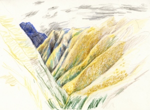 the rain has also backed off considerably. There was a full house at the hut with a couple of young Kiwi guys from auckland (Te Ara walkers) north bounders, A german couple who were reciently married on the trail (great fun to walk with)
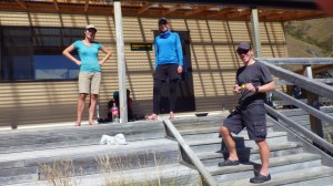
 The next day I set off with Melonie, Alex and Karin towards Highland creek Hut, we reached there by lunchtime, they decided to stay the night.
 so I said goodbye as there was enough time for me to get to the next hut – Rose hut. It was a bit of a grunt this next section two very steep climbs and descents. Many many snowberries were scoffed on the descent to Rose hut.
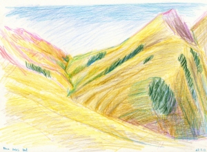
At Roses hut I met another couple of South bound TA walkers – Cisco and Roadrunner. We had a delight full day walking down the arrow river to mace town (an old mining settlement) where we found a massive feed of Blackberries and gooseberries.


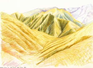

Twizel – Wanaka
Again Applogies in advance for typos – but im dam tired, wanted to get these posts written up before I hit the Takitimu’s tomorrow

This section began with a 33km walk from twizel to the Glen Mary Ski Lodge at lake Ohau. I didnt manage to get walking until lunchtime, so it got dark before I reached the Ski Lodge. Walking along the Ohau road was fine though and I knew where I was going as I had been there before. I checked all of the doors on the lodge but none were open(no suprises here), so as it wasnt raining, I was tired and couldnt be bothered pitching the snail, I slept on the back door step. Wish I had taken a photo of this one because it was pretty dam funny. 
Next morning up and away to climb 800m up Freehold Creak to the pass. Clear weather but a bit of a chilly wind, the pass was long and boggy, descending the other side was similar. I was aiming to get to the Ahuriri river but decided it would be unwise to cross the river in the fading light, so camped in a pine plantaion forrest about 1k from the river. A windy night. The weather was changing.


The crossing in the morning was fine, deepest flow was up to my knee but only for about 2m or so. They say that the hills in this area have the ability to move. In this case it was the river bank. It was shifting infront of my eyes. RABBITS. thousands of them. I wish I had a gun…the hunter tendancys in me were awakend. I was reminded of one of my favourite quotes
“The Rabbit is like the wind, it gets in your face and mess’s up your hair”
You have to be quite careful walking accross the feilds in the area as they are so uneven from diggings and full of anckle twisting rabbit holes.
Not far on from the river and the rabits I arrived at the Birchwood Road carpark (the spot I was aiming for the night before but didnt quite make it) and I seem to have stumbled without realising it another hunt. right infront (literally 2 or 3 meters) of me a Rekereke or New Zealand Falcon was in hot pursuit of a mohua who was trying to hide underneth the track entrance gate. Wow! a rare native bird being pursued by another rare native bird. The felcon I think was a bit of a poser and let me take some photos of him sitting on the fence post between launching his attacks. Im not sure if the Mohua got away or not as he made a dash for some Matagouri bushes not to far off but I lost sight of him. 
I was now headed for Marthar saddle, going was relativly easy as it was on a farm track all the way. After 3 km or so it began to rain, then it began to snow. Then I started to run because it was faster. there was a private hut marked on the map, so I decided to get to that, I figured even if it was locked there would at least be a side of the hut that was out of the wind, or I could shelter in the loo. I was so, so so happy when I arrived at Tin Hut to find it not only open, but full of firewood and had a comfy chair. Pretty cold and wet I lit the fire and had a brew to warm up, the snow was comming in thick. 
 even though it was only 12.30 I decide that if it didnt ease up I would stay here the night. By 1.30 there was blue sky again. on I went. On the ascent to Marthar saddle it started snowing. oh well. The track its self was a bulldozer track so it was very easy underfoot I pushed on over the saddle down the other sided to Upper Timaru Hut.
Unfortunatly, I arrived to a full hut. Full of hunters. they had been choppered in and it was there last night, they were friendly and were very appologetic about not having any space in the hut, and made me a cup of tea. They seemed mighty impressed that I had walked all the way from the otherside of the Ahuriri.
I pitched the snail, put on all of my clothes and hunkered down for the night. It was a bloody cold night too. foolishly, dispite a little voice in my head saying ‘bring your gear into the inside of the fly’ I left my shoes, sox and Gaiters out side of the tent. not only were my shoes, sox and gaiters frozen solid, but there was a thick layer of ice lineing the inside of the snail. I had to massage my shoes and shoelaces to get my feet into them. 
 By the way, I have given up on wearing tramping boots, they just kill my feet, so I just wear trail runners.
As the hunters were getting their chopper that day, they were packing up and gave me a heap of food. I downed 4 oranges, 2 oranges a banana flavoured ‘Up n Go’, half a packet of gingernuts, about 12 chocholate fingers, the took of down the river. great breakfast.

It was a bluebird day, the track notes said that it was 5 to 6 hours down the river track then another 2 hours up to Stodys hut. The river section was only 12 km and I thought “That cant possibly take 5-6 hours its only 12k”. Hahaha. It took me 5hours, in places the river travel was quite tretcherous, I was glad that there was the river level wasnt any higher, as it would have made some sections very scary.When you are walking on such demanding terrain and you have to make a consious desision about every single foot placement and hand placemnt it is very tireing. Climbing out of the river valley was steep but relativly quick about 80min.
 Stodys hut was fantastic. The most rustic hut I have stayed in yet, an old mustering hut with a dirt floor, open fireplace and friendly mice. dried out all of my gear from the frosty night before, had a feed, and watched the fire until all of the wood I gathered had burnt out. the hunters had given me a frieze dried desert of Apple Pie (yumo) and I had the best sleep i’d had in ages.
Next morning another cold but blue one. Climbed up to the ridge and motored along at cracking speed, I would get out to Hawea today.  I love the walkout days. the view from the ridge was truely majestic, Mt Aspiring never looked so good.
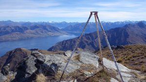 On the way down from Breast Hill, I met a lady coming up for a day walk Lucy, she offered me a lift into Wanaka. Hell Yeah. We ended up having some great yarns and exchanged contacts for possible future adventures. neat 🙂
Queenstown to Te Anau Via the Greenstone/Mavora
 Begining at the Greenstone track the walk into Greenstone hut was very cruisy. Flat well groomed track, company at the hut was entertaining with a Brit that could not stop talking about chocholate, scones and herself, a quiet German guy (retired teacher),and a friendly younger german girl (about my age) who kept asking me questions about my journey. I am really starting to get over people asking me about the trail, this is something I’ve been warned about.
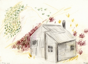
The walk from Greenstone hut to Careys Hut on the edge of the Mavora lake, was a plesant straight forward 28km. Sunny weather, relativly flat walking with a couple of huts to stop at along the way for lunch (Taipo Hut)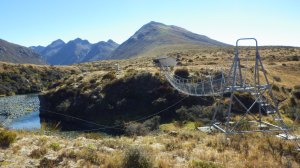 and afternoon tea (Boundary Hut). I knew that there was a party of 3 women ahead of me after leaving Taipo, so made it a mission to HUNT them down. About 3km away from Boundary Hut I spied a group of people sitting near a marker pole – HAHA! caught them. But no.
As I approached there was four of them and the looked like men. Hunters. As I got closer I thought, “dam that person looks familier”, I was my old school mate from Tokoroa, Peter Tucker. Pete and I were in the Tokoroa High School tramping club, and used to go on all sorts of missions. I actually contacted him prior to starting the Te Araroa and asked if he was keen to join me for old times sake, but never actually got around to organizing it, he turned up any way…bizare, but I am no longer suprised by things like this.
I caught up with the party of 3 women, and we spent the night in Careys Hut. The hut had a coal range stove for heating, which I got going but the chimny must have been blocked because it filled the hut with smoke rather than heat! That hut had a shower too, so it was great to have a rinse dispite being a cold one.
Next day the rain was forcaste to come in so got away smartly at 8am, for a 26km day to Kiwiburn Hut. The rain didint start coming in until about 4pm at which point I only had about half an hour to go. As it got dark the rain really started to pour down, I figured there was no way anyone would be walking into this hut, its all mine tonight 🙂 But NO. 3 soggy hunters turned up and ruined my serenity. I made a speedy get away in the morning as I didnt particularly want to see them again, and got away by 7.20am.
The Kiwi Burn Hut was about 1km up the Kiwi Burn (a small tributry that fed into the Mararoa river), The head high grass that grew on the flats was dripping wet and not only did I get immediatly soaked but in the haste of my morning escape I sliped over and fell into a prickle patch. *#%* (and words to that effect), At which point I laughed and said to my self “Ok you, slow down and take it easy” and I recited the line from the ‘Going On a Bear Hunt’ story….”Oh No – Tall grass…Cant go over it, cant go under it, have to go through it, swish swish swish “. The Kiwi Burn, was slightly discoloured and up a tad due to the nights rain, I was a little worried that the Mararoa River that I had to cross shortly would be flooded, if it was that would mean a backtrack of 3 km to the swing bridge. Luckily it was fine, I found a wide point and it was no deeper than my shin.
The trail followed a fence line down the river on the true left (The ‘true’ left/right is the down stream side of the river). This should have been easy. But Nooooo. On the trail side of the fence I was faced with my enemy – Tall Grass, and on the farm side of the fence – lovely groomed sheep farmed pasture. gee what a choice, I hoped the fence and walked for about 11km on the wrong side of the fence. there was another perk to walking on the wrongside of the fence….MUSHROOMS galore. My hunter/gatherer instinct kicked in and I couldnt walk past a mushroom without picking it. some I scoffed raw then and there, and also collected a decient hoard to have for lunch, and this morning at the hostel fried them up in butter…..mmmmmmmmm. The lovely sheep groomed pastures came to an end and turned into deer farm – which ment smaller paddocks and tall fences, and I couldnt be bothered with the trail bulshit near the river, so I headed over to the gravel road to walk the final 20km which took me to Highway 94 (the Te Anau road). The gravel road and the trail met up with the highway anyway so I would have ended up in the same place regardless. Then hitched a rided to Te Anau.
Long Days, Big Bad Rivers
After the Goat pass mountain run, the weather was due to pack in so I went back to Christchurch with Peter and Katie to wait out the storm for 1 day, this also meant that Peter could give me a ride around the Rakaia river, which was in flood due to the storm. My rest day in Christchurch was not exactly a rest, as we managed to go mountain biking and surfing on the same day….anyway,
Peter dropped me off on the southern side of the Rakaia river in drizzly, windy conditions. A 2 and a half hour walk up into the high country took me to the ultra cute Aframe hut for a spot of afternoon soup and a warm up, only another 6 kms to get to Comyns Hut I decided that I should keep on trucking. 
Comyns hut was little more than a glorified tin shed, with no firewood unfortunately. However it was dry and I was not. As I sat down to drink another mug of soup there was a ‘tap tap tap’…”Hello Hannah, How was your chicken soup?”….
…WTF…(when I stopped at AFrame I wrote in the hut book that I had stopped for chicken soup but was going on to Comyns)
I was caught by total surprise on the windy rainy late Monday afternoon middle of Canterbury high country nowhere to encounter another human… ” I have been following you for a while, can I come in?”
Thomas. Trail name – Rattlebee. German, Ultralight, Speedhiker (think Greyhound) who decided that he wanted to complete the trail in double figures – i.e. under 100 days. This meant averaging 40km per day…wow!, however I can kind of see how this is possible if you are only carrying 6kg or so (including food). My pack on the other hand weighs at least 15, and I am carrying a Frisbee for god sake. I need to down size.
Anyway, we discussed the fact that we were both a little anxious to cross the Rangitata river alone, so decided that it would be best if we stuck together until it what been crossed. As Rattlebee could cover nearly twice as far as me in a day, I took off about an hour or so before him, stream bashing in the rain, then he chased me down. Of cause he caught me shortly after about 2hours at the top of the crappy little stream, just as the trail got into some serious tussock bashing. Basically there was no track only shoulder high tussock bushes (that is my shoulder we are talking about), a jungle of Spaniards (Spaniards are my most hated alpine plant, it is a type of spear grass that has leaves like knives that will prick you and slice you if you are not paying attention), and the occasional warratah with a bit of orange PVC pipe to indicate the route. These were often hard to spot. As I bashed my way up to the 1500m saddle it began to snow large sloppy snowflakes. Wonderful. Half way down my descent I dropped below the cloud line, and far in the distance I spotted a wee dark speck was scampering along…Rattlebee…I was glad to have company in the shitty weather, and when I arrived at the hut the fire was blazing, the rain had stopped and the clouds were starting to break up.
From reading the hut book we learned that Harold (the French guy I walked with through the Nelson Lakes) was only a couple of days ahead of us, and had had some weather worse than ours. 

The next day was a cracker! crisp dry morning, not a cloud. I got walking early, Rattlebee had chased me down and overtaken by mid morning. We agreed that we both wanted to get as close to the Rangitata as possible, we decided we would aim for Potts river bridge. feeling a little intimidated by the prospect of walking 39km, I looked at the map and did some calculations in my head and figured the terrain was relatively flat, and I had just enough daylight to make it. I felt pretty stoked with myself that I made it, walked into the camp site at 7.45pm, I could never have thought I would be able to walk this far at the beginning of Te Araroa. Rattlebee admitted that he had doubts as to weather I would get there.

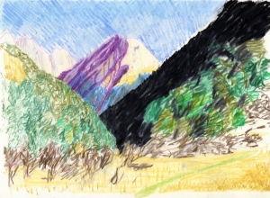
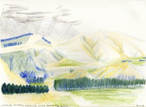
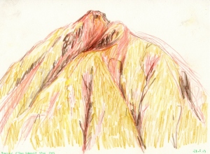
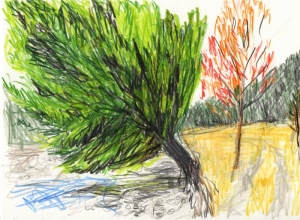
The morning light hitting The Pyramids was really pretty. I love drawing in the morning light because it means I get to use my pink and red pencils…its the small things.
We both felt confident about our crossing the Rangitata, it hadn’t rained for a couple of days, and the tributary – the Potts river was running clean and crossable. The previous day we also ran into a Te Araroa walker who was heading north and said that he had crossed it around about mid thigh hight. 
The river turned out to be a piece of cake, I think that we crossed it higher that the GPS route, it was never higher than my knees. However there was a bog on the other side that was a bit dodgy, as it was full of hidden leg trapping ditches covered cunningly with floppy grass. 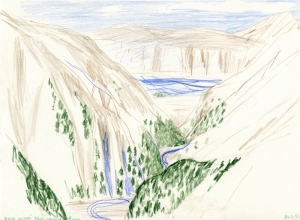
The real hazard on this day actually turned out to be the next stream/raging torrent that we had to walk up for 8km’s or so – Bush Stream. t wasn’t like bush stream was in flood or anything, it was the combination of fast flow, medium to big sized boulders in the stream bed, and the fact that the track was the river, that made this far more treacherous than the great Rangitata.
The climb from bush stream up to crooked spur hut was steep, but the views from the hut were just outstanding. I said goodbye to Rattlebee as he wanted to keep on going to Stone Hut another 8km away. I was feeling a bit stuffed and also wanted to make some more drawings of this place. 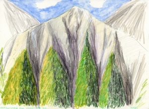
The next day I decided I wanted to do a long one, as yesterday I only did 18km. This was going to be a 29er with two mountain passes to cross, one of which was stag saddle the highest point on the trail, a good day to do it too with kick ass weather. 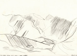
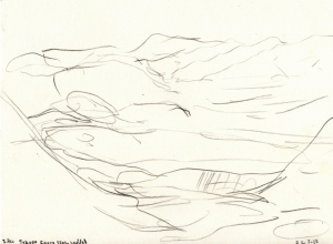
I reached Stag saddle at 3.30 in the afternoon, a truly awesome Te Araroa moment brought tears to my eyes as I look out over lake Tekapo and Mt Cook standing proudly on the horizon to the south west. I left the saddle at 4pm. Rather than following the very widely spaced marker poles and tussock bashing my way down the valley for 9km, I should have taken the ridge, which apparently has a very well beaten track and is one of the best bits of Te Araroa. My tussock and bog bash quickly turned into what Rattlebee would call RAGEHIKING – this generally is constituted by a feeling of anger or rage and long chains of 4 letter words directed at the trail, the terrain or the weather. I don’t think that I have been happier to get to a hut than I was on this day, this 12 hour day. Camp stream hut – my paradise till the next morning when I was to walk out to Tekapo village. 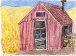
Lewis to Aurthrs, Goat Pass,
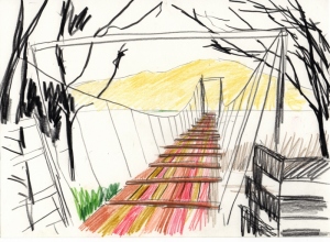
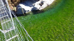
Swing bridge before Hope Kiwi Lodge.
I am running slightly behind schedule with regards to my blog posts, so this one will consist of more images than words…not that this is a bad thing.

After returning to the trail after a week of break (well sort of as I went to play the Queenstown disc golf tournie), Katie dropped me at the trail head of the Hope River at 4.45pm, for a 3 hour walk in to Hope Shelter.

Walking up the hope river in the early morning was just great, and after an hour and a half I arrived at Hope Kiwi Lodge for breakfast and coffee. 
From here I had about 5km with a vertical ascent of only 70m to climb up to Kiwi Saddle, and then dropped down to lake Sumner. 
 From Lake Sumner the track went off to the right through the beach forest for 7km’s or so, however this was pretty much pointless as to the left of the bush track lies a 2km wide riverbed used for grazing cattle. I thought to myself “gee what should I do, continue to follow this unnecessarily lumpy, rooty forest track with fallen trees to navigate, or charge up the grassy river plains?” Plus I had a clear view of Hurunui hut from the river.

The next day from Hurunui Hut I was headed up to Harpers pass and down to Locke Stream Hut. This was to be a big day so I got up at 5.30am to get walking as soon as it was light enough to see the trail. The early morning is always when I do my best walking and cover the most ground, also the time to take the best photos because of the light. 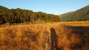
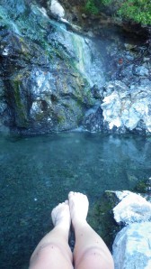
I was particularly excited that I would be walking past some natural hotsprings, which in the track note’s were described as a “Te Araroa highlight”. The track pretty much crossed directly over the hot springs, and there was a pool big enough and wide enough to comfortably submerge 3 adults. Lucky I was alone I stripped off to get in….they must have smelled be coming and new that this place was a feeding station…sand flies immediately launched their attack thousands of the little fuckers. I quickly made a dash to get submerged as fast as possible. dipping my toes in the water was absolutely scolding…no mercy. Managed after a few minutes to get into the pool up to my knees and promptly cover the rest of my skin with clothes.
Anyway, kept on tramping and passed 3 more classic huts on route to Harper pass – Hurunui No.3, Cameron Hut (This one that I probably wouldn’t want to stay at) 


. Also along this stretch crossed my first 3 wire bridge…Cool

There are said to be Kiwi on the Harper Saddle, I didn’t see any as it was day time still, but I did see lots of sign in the sand and dust as I semi bush bashed up the over grown track to the saddle.
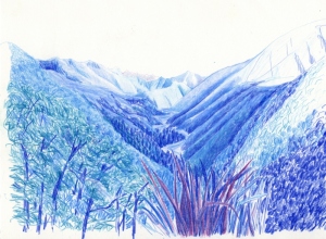
 Along the way my maps dropped out of the my pack side pocket…bugger, so with still 5km or so to go descending to Locke Stream Hut the rest of the afternoon turned into a bit of a boohoo.
I was happily surprised when Locke Stream hut appeared in front of me in just over an hour. 

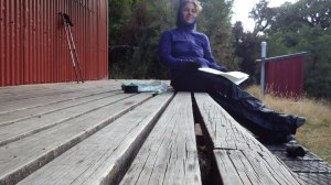 This hut has to be my favourite so far, Beautifully restored, the inside of it is mostly in its original state, with the hand milled floor still in great condition. Had a great end to the day drawing out on the deck, and I had it all to myself 🙂


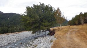 The next day was a long valley plod out to Morrisons foot bridge.
 I stopped at Kiwi Hut for lunch and was joined by a curious wee Robin who hopped courageously into the hut.



Was super happy to meet Peter, Katie and Rose at Morrison’s footbridge at the very end of the day. 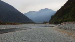


We made camp at a roadside Doc Camp site, so great to have someone else cook something that wasn’t Freeze dried. 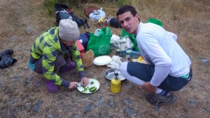

As the weather was due to crap out on Sunday, we decided that the best idea would be to run pack-less up Deception valley over Goat Pass and down the Minga valley to the Arthrs Pass road (this journey would normally have taken me two day). Peter and I started of at 8.30am with light day packs and running shoes, 
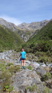
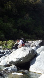

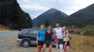 Katie and Rose drove the car to the other end of the trail, then hitched back and proceeded to chase us down like prey.
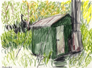 With out a backpack I was fast and light and rock hoped my way up the Deception valley….Seriously Fun. A big feed of bangers and mash at the Wobbly Kea in Aurthrs pass at the end of the day was a great reward for our efforts.
More Soon
Happy trails
love Han
Queen Charlotte, Richmond, Nelson Lakes
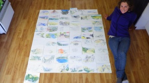 drawings laid out on Peter’s kitchen floor…I will appologise in advance for the spelling and grammatical errors of this post. It is late, I am tired and I still need to organize my stuff for tommorow……here goes
Queen Charlotte Track – The queen Charlotte track was somewhat of a disappointment. It is very much the honey-mooners walk, almost everyone on the trail seemed to be slightly loved up couples, I was super glad that my friend Katie was with me. We left Picton on the Endevor (a catamorang water taxi) and got dropped at Ships Cove with about 10 other walkers. A cloudless day, we climbed up through mixed podocarp forest to the ridge. The track its self seemed to have be made by a small bull dozerdozer, so Katie and I were able to walk side by side most of the 72km track. Apart from the occasional clearing every couple of hours, we were in bush most of the time. But I did get a chance to make some drawings of the sounds.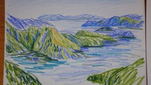
 We completed the track in 3 longish hot days. At our last camp, Portage Bay I snapped one of my tent poles…broken snail (very gutting). So I decided to go to Nelson to the Mountain Designs store with the hope that they would help me fix it… they didn’t.
Richmond – After a day rest, in Nelson I began the Richmond Ranges section of the trail beginning at Hackett Creak. A long, hot, steep climb up Mt Starveall to Starveall hut. I arriving there at 4pm and I still had several hours of light, so I boiled the billy, had some snacks and pushed on to Slaty hut two and a half hours on. The Richmond ranges are very pretty, the rocky slopes of Mt Starveall are made up of small fragments of slate but all different pastel colors – blues, purples, greys, greens, pinks, a most inspirational pallet, I had to control myself not to continually take photos of the ground. However the Fuji ‘point and shoot’ made it very difficult to do any justice to what was going on under my feet.
 Slaty hut is just above the tree line, a cute wee hut with a log burner to cook on. As I had the hut all to myself I heated a pot of water, stripped off and had a wash. This has become a regular end of day ritual. With the fire cranked up I was able to slow cook a pot of Quinoa, with mushrooms, lentils, and sun-dried tomatoes, what a luxury -slow cooked.
I woke to the most glorious dawn. From 1400 meters or so, looking down at the blue-black ranges peeking out of the morning sea of cloud.
 Purple and peach colored clouds slowly becoming yellow with the rising sun. I took off on the first section of the day – over to the junction of Old-Man Hut track and Mt Rintoul. After about 2 hours as I descended onto the plateau I heard this whaling sort of crying sound.
  The sound was somewhat chilling, though I had an inkling that it was not a human sound. I yelled “ARE YOU A PERSON”… no response. I yelled again…no response once more, then I heard the same cry but from much further away….Goats! Later on that day I saw a herd of 5 on the slopes of Mt Rintoul.
Mt Rintoul has two peaks – little rintoul and big rintoul, between the two is the scariest knarliest saddle ever. I can say that I met my challenge on this mountain,  it would have been a shit of a place to have been in bad weather. Very steep and unstable ground one wrong step and you are a gonner. I think the scariest thing about this place was that everything was loose, High and steep is fine but high steep and loose is terrifying. Lucky for me the weather was perfect. It was one of those ‘kiss the ground’ moments when I reached the hut at 5pm on the other side or Rintoul. Hut to myself again, no human sightings today.
The next day – up a mountain, make a drawing,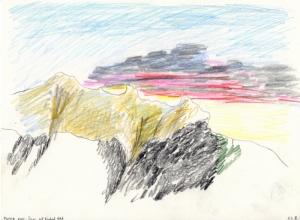 down a mountain, lunch at a cute little hut, down a ridge to a river….this was a great day until…I droped my camera into the river, now it really didn’t work. I was quite upset about this tragedy, not because of the loss of the camera its self, but I wasn’t sure if I had just destroyed all of my photographs from my entire trip, and I wouldn’t be able to find until I got to St Aurnaud in 3 days time….I had an extra strong Milo and some chocolate to make myself feel better. Hut to myself again, no human sightings today.
 Day 4 in the Richmond, 5 hours up the Waiora river to lunch at upper Waiora hut. A bit of a shit of a track, most of the time rugged rooty scrambly. From there a sidling climb up to the mt Ella saddle.
  At the saddle I could see the hut glinting in the far far distance, and then I looked at how far I still had walk. This was a fine moment. I think it was the combination of the Rintoul anxiety, loss of camera, no human contact in 4 days and the distance i still had to walk to get to the hut, my first genuine BooHoo :(. I always knew that there would be a few boohoo’s along the Te Araroa journey, so at some level I wasn’t too phased and knew that I just needed to cry out what needed to be cried out, council myself a little and keep on walking). By the time I go to the hut I was all smiles again, And it was such a beautiful hut.
  Hunters hut was built-in memory of two dock workers killed by a landslide whilst working in the area.
Day 5 in the Richmond ranges I had now entered the area called the Red Hills. The Red Hills get the name from the rocks Red Chert that the mountains consist of. It is like walking through a very hilly Australian landscape, with no Australian animals. 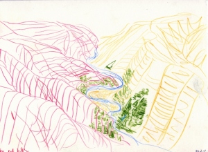 Seeing that I now only had my sketch book to capture my journey I drew more this day.
 The next day a 8km down hill walk out to the road then a 12km road walk to St Aurnaud (the gateway to the Nelson Lakes National park).
 Getting to St Aurnaud was great, a felt like id reached a mile stone so celebrated by jumping off the wharf into lake Rotoiti and bacon and eggs for dinner. I found out that my memory card from my camera was fine, what a huge relief. Another happy moment was collecting my food box that I had posted ahead of time, including gas, loo paper, chocolate and the maps for the next section – the nelson lakes.
Feeling happy, fed, clean and organized, I decided I didn’t need a rest day and walked back in to Upper Travers Hut. 
 From Upper Travers Hut I went up over Travers Saddle to lunch at West Sabine hut. there were two guys sitting on the deck of the hut so I was happy to have someone to yarn to, but better than that was they were experts in bush baking. they had this tiny little bush oven and had just baked some thing – cheesy bread type scone thing – WOOHOO nom nom nom. Thankyou boys.
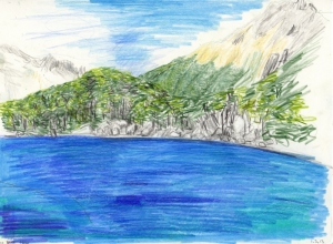 I then pushed on to Blue Lake hut. The Blue lake is perhaps the purest water on the planet. It was formed by a massive land slide about 10,000 years ago that created two lakes Blue Lake and above that Lake Constance. Lake Constance sits about 100m directly above the Blue Lake. the water from Lake Constance is filtered through the land slide and dribble out the bottom into the blue lake, thus the blue lake is so clear, pure and luminous it looks as though it has been lit from below. It is ice cold.
At Blue lake hut I met two other Te Araroa walkers – Graham (a scrap metal dealer from Masterton) who liked to put jelly beans in his water, and Harold ( a french chef who carried all of his food in plastic snap lock containers, including 500g of butter in its own snaplock container. His pack weighed 30kg. I can think of other ways to torture myself).  I was so grateful for the company, especially to walk over Waiou pass (1870m the second highest pass on The Trail).
 We were headed for Caroline Biv, basicly Caroline Biv looked like a garden shed with two sack bunks. I figured we would have to draw straws to see who was going to sleep on the floor. We were a bit surprised when we arrived that there were 4 hunters already there, as I didn’t have a tent or a bed roll with me, it looked like it was going to be a night under the stars.
 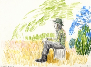 It proved to be a dry night, even though it was threatening to rain as the light started to fade. I wore all of my clothes in my sleeping bag and used my pack, packliner, gaiters and emergency blanket as a bed role. Not a bad sleep but I was glad to get walking again the next day and move on.
Walking down the Waiou river valley I really got the sense of the distance that I was and am walking.  The valley was just massive. Looking down as far as I could see and thinking, that’s where m going! a 25km valley plod. The next day was much the same, as was the day after that. We got out of the bush at Lewis pass and hitched to Hanmer springs. there was only two things on the mind – burgers and beers. My brother peter then came to pick me up and I had a week of R&R and disk golf.
I hit the trail again last Tuesday a walked from Lewis pass to Arthurs pass. I will blog that section at a later date. right now I need to go and pack for tomorrow as I am heading back in to walk an 8 day stint to Tekapo.
To the End of the Island
 Sitting in backpackers lounge in Nelson, finally found time to make a much out dated blog post. I finished the North Island on Friday, somewhat anti climactically. Expecting to see some sort of sign or confirmation that I had reached the end of the North Island of New Zealand, there were only the waters of cook straight and the fishing boats of Island Bay before me.
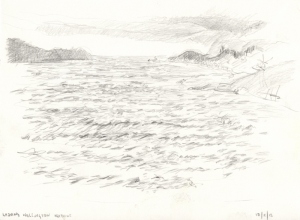 Needing to somehow mark the occasion I took of my boots and waded in the lapping brine. Then promptly walked back where I came in search of a bus back to Courtney Place, and a lime milkshake…I found both. However to step back in time a few weeks and fill in the gaps up until this point, reads as follows.

I started back on the trail at Mangatepopo on the western side of Mt Tongariro, after some well-earned time out with Granny and other friends in the Corromandel.  My little sis kindly dropped me off up the Mangatepopo valley in full sun, surrounded by thousands of tourists, Ahhh trail serenity. That place is a highway. Happy to be back on the trail, big grin on my face I said ‘hello’ to every one I passes, doing my best to be the friendly, slightly too happy, New Zealander amongst all the visitors. I made my way over the southern part of the Tongariro Crossing, over south crater
 , across red crater
 , past the emerald lakes
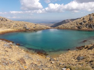 and then down to Oturere Hut (which is on the desert road side).
  Walking down from emerald lakes is like being on another planet, the volcanic rock formations growing like tumors from the dark gravely sands. A swim/bath in the surprisingly warm Oturere stream at the end of the day was a treat for the first day back on the trail.
In the morning I set out headed for Rangipo hut on the southern side of Mt Ruapehu. These mountains are so big and fresh and raw and powerful, they seemed to have a presence radiating from them.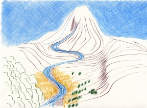
 I stopped several times to draw, and loads of times to photograph the scenery surrounding me, desperately trying my best to capture the experience and vista of the place. I had Rangipo hut all to my self that evening, which was just great! meant I could spread my stuff around the hut and get changed without needing to consider anyone else. I dragged one of the mattresses out onto the deck to watch the vehicles driving along the desert road, and the distant Kaimanua ranges turning from green to blue to black with the fading day.


Waking to a cloudy morn I continued on to Blyth hut. A pleasant overcast day of walking, beginning with rocky alpine, to the tussock and scrub, then down through young beach forest. The only two humans I encountered were a couple of Germans at the hut. Friendly enough they offered me some wine; I didn’t refuse, despite very little English. As I speak no German at all communication was reduced to much pointing hand waving and drawing pictures to explain that I was attempting to walk the length of New Zealand, with the occasional car, bus and boat ride (no way am I a purist regarding this long distance walking). I sat on the deck with the Germans and sketching the sunset….picture perfect indulgence!
The next day was down the mountain and out to the road. The Blyth track was built in the 1930’s by Mr. Blyth (hence the name), the original board walks of tree trunk halves laid horizontally across the track in order to combat mud, were still intact on the track. Glad to be off the mountain, I headed to the nearest café for coffee and eggs benedict before heading over to Raetahi where I was to meet the van ride to paddle the Wanganui River. I really had no desire to walk down roads for 4 days to get to the river. 
After an hour or so van ride, the briefest safety briefing ever, the heavens opened, the rain came down, and away I went kayaking down the Wanganui in the Penguin (that was the name of my vessel, a fancy orange sea kayak). Paddling was a welcome alternative to walking, and rapids are great fun, and seemed to feel quite natural. The first night camping at John Coull campground was a bit soggy. Huddling under the shelter with fellow soggy paddlers, at the first break in the down pour two helpful English adventures (Peter and Libby) helped me erect The Snail (my tent has been nick named the snail) before the rain returned to ‘falling with intent to half drown’.
By morning the rain had stopped, though the river had risen about 1.5m over night. This was a good thing as now there was more flow so the travel was faster. The river canyon was extremely beautiful not to mention peaceful. This is a place, like many places in New Zealand where wilderness and inspires wonder, something ancient, something untamed. I wish I could have drawn more but it was a little difficult from the penguin. 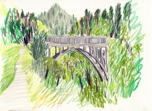 That night I camped at the Tieke Maraee/doc hut/camp site. Very pretty with terraced grassy campsites, the clouds had cleared and we had a starry but cold night. I had to wear all of my clothes and was still a bit nippy.
The last day was a sunny and the river looked glorious. The shoulders of the hills slowly opened the further down the river we went, and native bush began to turn into farmland and pine plantation. Exiting the river at Pipiriki, I got a ride from Libby and Peter, the English couple, down to Wanganui to stay with friends Sprout and Frances for a couple of nights before heading over to Levin to commence the my final leg of the North Island – Levin to Island bay (wellington).

I met up with Gemma (my old flat mate and friend from art school days) in Levin and we headed into the Taurarua ranges. I was keen to have company for this 4-day section as the Tauraruas have a wicked reputation for being very steep, knarly and whether that can change at any moment. The first day was a 5 hour, relatively gentle climb up to Waiopehu hut, a nice new clean hut with panoramic views across Levin to the sea, up to Mt Taranaki and over to Ruapehu…Stunning. Gem and I settled in, then sat out on the deck to do some sketching.  2 other trampers turned up, Simon and Brad from wellington. They made for good hut company, sharing their cider plus a couple of rounds of semi competitive UNO.
We set of early the next day (as it was going to be a long one, 10hours). Fog covered the valleys below like a vast fluffy sea as Kapiti Island bobbed away to the south.  We climbed Waiopehu Knob, scoffing some snowberries at the summit, before a long traversing descent to Te Matawai hut for lunch.
  The steep 2-hour climb after lunch was rather tiring in the heat of the day, and then another long ridgeline decent through the most Dr Susse like forest I have ever been in. We reached Dracophyllum hut around 7pm, a very cute 2 bunker with spiders and a cockroach
 . Very satisfying to have it to ourselves and watch the sun going down.
Then long day must have taken a bit of a toll on me as the next day I woke with a sore throat and blocked nose, so a slow start to what was to be a very long day (11hour). The whether had come in over night and it was cloudy and drizzly. Not ideal. More Dr Susse forest, pretty rugged track, ups, downs, and a minor detour we made it to Nichols hut for lunch at 3pm. We were very much in need of some Mei Goring noodles and a cup of tea. Still very poor visibility, it was up and over Mt Crawford which took about 3hours, to the descend 1200m to reach Waitiwaiwai hut on dark. What a knackering day!
In the fading light we decided an end of day wash in the Otaki River would be a treat. Half naked splashing myself with the fresh water, several eels swam very closely to check us out. Slimy, wriggly things in the dark are not a favorite, we both screamed loudly and ejected ourselves from the river. Yuck eels.
The walk out the next day was a cruisy 5-hour affair, following a stream up over a low saddle. Glad to be out of the bush we hitched a ride with the friendly couple we met in the hut. I hopped out at Paraparaumu and camped at the campground. Went through my usual routine of being back in civilization, re-supplying my food, doing laundry, showering, drawing, making some notes of the walking and organizing myself for the next leg.
The walk from Paraparaumu to Porirua was LONG. 30km is right on the outer limit of what I can handle, it is painful and takes all day. But I made it. A cheap, little bit grotty, campground below Colonial knob did my just fine for the night. A leisurely start to the next day I didn’t get going until 9.30. A sunny day, from Colonial Knob the first glimpse of the south Island brought a tear to my eye. I sat at the summit and drew the Cook Straight and the Malbourgh sounds in the distance.
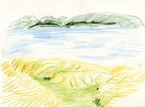 After descending the Knob, I was escorted (by the stop and go people), through some serious road works, on the road over to Mt Kaukau. I reached the summit of Kaukau at 6.30. I got talking to a runner, Karen, and asked for directions/advise. I told her what I was doing and she offered me a hot shower, food and bed. I couldn’t say no to that, plus she just lived down the hill. Fate must have been intervening again, as on the way down she said she a couple of her tramping friends Simon and Brad went tramping the weekend gone in the Tauraruas, I said “oh I know Simon and Brad I met them up at Waiopehu hut”. A small, small, small world. Had a lovely evening talking about life and sharing tramping stories. Many thanks to Karen; it was so lovely to meet you.
Karen dropped me off at the Wellington gardens the next day. From here I walked into town and met up with Gemma for lunch,
 cruised around Cuba St for a wee bit, checked out a fringe event down by the waterfront. I left my backpack at Gemma’s house, and finished the last 2 and a half hours of the island pack less, what a luxury.
For now its time to get some sleep and tomorrow I head into the Richmond ranges walking to St Aurnard. Weather looks good and I am now in my next pair of boots. YAY.
Happy Trails
Han


